发布时间:2025年9月24日 16:37
类别:
Page Views: 10 views
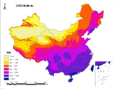
The "China Annual Precipitation Spatial Interpolation Dataset (1980-Present)" is generated from daily observational data collected at over 2,400 national meteorological stations across China, processed through data collation, computation, and spatial interpolation techniques. Annual precipitation is recorded in units of 0.1 mm (numerical values are scaled up by a factor of 10; dividing by 10 yields actual values in millimeters).
For interpolating climatic variables like precipitation, the Australian-developed ANUSPLIN interpolation software is utilized. ANUSPLIN employs smooth spline functions to analyze and interpolate multivariate data—a method of approximating surfaces via mathematical functions. This tool supports rigorous statistical analysis, data diagnostics, and spatial distribution evaluation to achieve precise spatial interpolation (Hutchinson M F, 1998).