发布时间:2025年9月24日 16:37
类别:
Page Views: 9 views
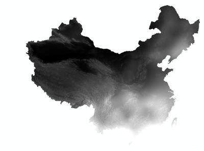
The spatial interpolation dataset of annual precipitation in China from 1980 onwards was generated through processing daily observational data from over 2,400 national meteorological stations. The dataset underwent systematic collation, computation, and spatial interpolation. Annual precipitation values are recorded in units of 0.1 mm (equivalent to multiplying actual values by 10; dividing by 10 yields measurements in millimeters).
For interpolating precipitation and other climatological variables, the ANUSPLIN interpolation software (developed in Australia) was employed. ANUSPLIN utilizes smooth spline functions for multivariate data analysis and interpolation, effectively approximating surfaces through functional methods. It enables robust statistical analysis, data diagnostics, and spatial distribution modeling to achieve accurate spatial interpolation (Hutchinson M F, 1998).